
Many factors play a role in determining a machine's position accuracy. First and foremost, which part of the machine are you trying to measure?On dozers, our BenchManager machine guidance system measures the machine's elevation at track level. Track elevation tells us how the terrain is built. These measurements are the same as those taken by surveyors, but they are taken continuously at a much higher resolution. Typically, surveyors only take measurements every 10 to 20 metres and the flatter the terrain, the fewer points they measure. BenchManager Dozer, on the other hand, takes measurements two to five times per second and records its data every two metres.
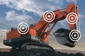
Accuracy calculations are different for shovels, though. Our system gets its positions from GPS and GLONASS (plus Galileo or BeiDou, if desired). At the antenna, this position is accurate to about two or three centimetres. The system's dual GNSS antenna setup also provides a heading that is accurate to about 0.4 degrees. This dual antenna configuration means that measurements further away from the GNSS antenna have a larger position error. (Estimated error is calculated using the formula: position error from heading = distance from antenna X sin(heading accuracy)).In general, big shovels like the Hitachi EX8000 and the Hitachi EX5500 will see relative precision of their buckets around 30 cm. A recent survey of a Hitachi EX5600 running BenchManager provided bucket position of better than 20 cm horizontal and around 10 cm vertical. Many factors are at work with these systems, but we generally say 30 cm or better precision for shovels using BenchManager with the Arm Geometry System. Smaller equipment can expect smaller errors and larger equipment, larger errors.These figures are simply guidelines. As good as our equipment is, it still requires surveyors to take accurate measurements so that our software can compute the solutions accurately. Our system also depends on satellite geometry to get the best positioning possible. Deep inside mines, that satellite availability decreases so we use at least two satellite constellations (three, if necessary) for high-precision.When analyzing the accuracy and precision of a high-precision shovel, we can't use a single measurement at an offset location or bucket position. We take several measurements and use them to determine the average position difference (the accuracy) and standard deviation (the precision) of all measurements. For dozers, we rely on a controlled surface measured by surveyors. We drive the dozer using BenchManager over this surface and compare the two results. In this way, we know the accuracy and position that our high-precision system can give to mine equipment.